TripFinder

Compare multi-day small-group tours from independent operators, then ask a Canadian travel advisor for help.

Explore

Find tripsDestinationsTravel stylesDealsCompare trips

TripFinder

How it worksTalk to an agentAbout usContact

Good to know

Privacy PolicyCookie choicesTerms of UseTravel guides
TripFinder.ca helps you compare small-group trips from independent operators and book with a TripFinder travel advisor. Trips are operated by the tour companies under their own terms. © 2026 HighBar Enterprises Ltd.Made for adventurers in Canada 🍁
TripFinder
Find trips
DealsAsk TheoCompareHow it worksBrowse all trips
Tour de Monte Rosa Guided Hike
Find trips›Switzerland›Tour de Monte Rosa Guided Hike
UTOperated by UTracks

Tour de Monte Rosa Guided Hike

From
CAD 2,790
Duration
7 days
Countries
Switzerland
Activity
moderate
Rating
★ 4.4 · 12 reviewsvia UTracks →

The adventure

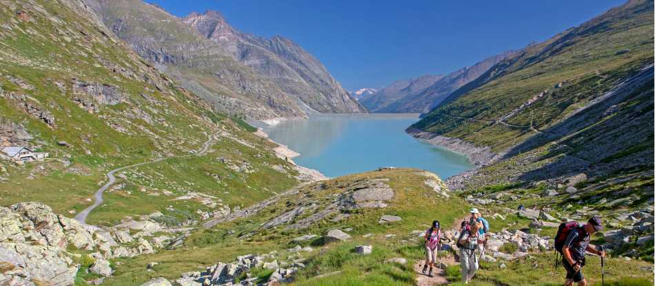
Tour de Monta Rosa Walk: Traverse the second highest peak in the European Alps on foot to discover a fascinating world of rock, ice and 4000m giants

At a glance

Duration
7 days
Route
→
Countries
Switzerland
Activity level
moderate
Style
Trekking & Hiking
Group size
Ask
Flights
Not included
Solo travellers
Ask an agent

Day by day

Stunning aerial landscape of a Swiss lake surrounded by majestic mountains under a cloudy sky.
Your journey through

Switzerland

Day 1Day 1: Meet group in Grächen and hike to Saas Fee (6-7hrs)A warm-up day. Meet your guide and group this morning (8:30am) and take a cable car to Hannigalp then skirt the northern peak of the massif and discover a breathtaking view over the Rhone and Saas valleys. A pleasant path leads us to the famous village of Saas Fee (1800m). Distance: 17km/10.5mi Elevation: +650m/2132ft, -500m/1640ft
A warm-up day. Meet your guide and group this morning (8:30am) and take a cable car to Hannigalp then skirt the northern peak of the massif and discover a breathtaking view over the Rhone and Saas valleys. A pleasant path leads us to the famous village of Saas Fee (1800m). Distance: 17km/10.5mi Elevation: +650m/2132ft, -500m/1640ft
Day 2Day 2: Trek to Macugnaga via Monte Moro Pass (2868m), (6-7hrs)We ascend the path to Mattmark Lake before taking on the legendary pass of Monte Moro (2868m), a very ancient link between Saas Tal and Macugnaga. This passage was used by the German Walser people when they immigrated to this region. Continue to the village of Macugnaga (1327m), nestled under Monte Rosa peak. Distance: 15km/9.3mi Elevation: +653m/2142ft, -1500m/4921ft
We ascend the path to Mattmark Lake before taking on the legendary pass of Monte Moro (2868m), a very ancient link between Saas Tal and Macugnaga. This passage was used by the German Walser people when they immigrated to this region. Continue to the village of Macugnaga (1327m), nestled under Monte Rosa peak. Distance: 15km/9.3mi Elevation: +653m/2142ft, -1500m/4921ft
Day 3Day 3: Hike to Alagna via the Turlo Pass (2738m), (6-7hrs)Today we will climb up through the Quaraxxa Valley to the Turlo pass (2738m) before hiking along the southern slopes of Monte Rosa. Our descent through the open pastures of Alesia leads us to Alagna (1191m), another picturesque and remote place in the beautiful Aosta Valley. Distance: 21km/13mi Elevation: +1431m/4694ft, -1163m/3816ft
Today we will climb up through the Quaraxxa Valley to the Turlo pass (2738m) before hiking along the southern slopes of Monte Rosa. Our descent through the open pastures of Alesia leads us to Alagna (1191m), another picturesque and remote place in the beautiful Aosta Valley. Distance: 21km/13mi Elevation: +1431m/4694ft, -1163m/3816ft
Day 4Day 4: Continue through the Val d'Otro to Gressoney (7hrs)We hike through the Otro valley, passing by its numerous pastures, before reaching the Olen Pass (2881m). From here we hike down through the pastures of Mos towards the valley of Gressoney and the hamlet of Gaval. During the hike the peak of Liskamm is a constant source of inspiration in the background. Distance: 11km/6.8mi Elevation: +1727m/5666ft, -524m/1719ft
We hike through the Otro valley, passing by its numerous pastures, before reaching the Olen Pass (2881m). From here we hike down through the pastures of Mos towards the valley of Gressoney and the hamlet of Gaval. During the hike the peak of Liskamm is a constant source of inspiration in the background. Distance: 11km/6.8mi Elevation: +1727m/5666ft, -524m/1719ft
Day 5Day 5: Ascend high passes and descend via…This morning our hike takes us through the pasture of St Anna before taking on the Bettaforca Pass (2617m), directly underneath the imposing peaks of Castor and Pollux. The descent to the Ayas Valley presents a superb panorama showcasing Champoluc village, the hamlet of St Jacques hamlet as well as Forca Lake. Distance: 20m/12.4mi Elevation: +940m/3084ft, -1240m/+4068ft,
This morning our hike takes us through the pasture of St Anna before taking on the Bettaforca Pass (2617m), directly underneath the imposing peaks of Castor and Pollux. The descent to the Ayas Valley presents a superb panorama showcasing Champoluc village, the hamlet of St Jacques hamlet as well as Forca Lake. Distance: 20m/12.4mi Elevation: +940m/3084ft, -1240m/+4068ft,
Day 6Day 6: Hike above Cervinia ski resort -…A beautiful day with glaciers, glacial lakes and alpine meadows as we climb through the Cortox Valley to the aptly named Cima Blanche (white) Pass (2982m), above the famous ski resort Breuil Cervinia. We ascend to the Theodule pass (3295m/10,810ft) and spend the night at the Theodulo mountain refuge (3317m) which is just above the pass. Note: You will need to carry your overnight gear including sleeping sheet, clothing and toiletries as luggage transfer is not possible today. Your luggage will be transferred to Täsch, for collection tomorrow. Distance: 17km/10.5mi Elevation: +1500m/4921ft, -466m/1529ft
A beautiful day with glaciers, glacial lakes and alpine meadows as we climb through the Cortox Valley to the aptly named Cima Blanche (white) Pass (2982m), above the famous ski resort Breuil Cervinia. We ascend to the Theodule pass (3295m/10,810ft) and spend the night at the Theodulo mountain refuge (3317m) which is just above the pass. Note: You will need to carry your overnight gear including sleeping sheet, clothing and toiletries as luggage transfer is not possible today. Your luggage will be transferred to Täsch, for collection tomorrow. Distance: 17km/10.5mi Elevation: +1500m/4921ft, -466m/1529ft
Day 7Day 7: Continue to Zermatt, trip concludes (6hrs)After making our way back across the Theodule pass we re-enter the Valais and Vispertal region. The final leg of our hike will see us descend across a glacier to Trockener Steg and Zermatt, with the famous Cervin, or Matterhorn, in the background to bid us farewell. Hiking concludes in Zermatt around 2pm, then taxi to Tasch just along the valley (to collect luggage). Depending on your fitness and weather/mountain conditions, there may be an option to ascend the summit of Breithorn (4165m) today, one of the most climbed +4000m peaks in the western Alps. This involves some organisation on your guide's behalf in respect to engaging a UIAGM qualified mountain guide and climbing equipment. The additional cost is approximately EUR460 for 1 or cost can be shared between 2 clients. This includes the mountaineering guide, crampons, harness and group climbing equipment. One way cable car fare is separate - approx EUR90. This must be paid for in cash locally. There are some technical aspects to the climb requiring care and attention at all times. The decision not to ascend will be at your guide's discretion based on current conditions and your fitness. Those not ascending Breithorn will take the route described above with your hiking guide. Distance: 10km/6.2mi Elevation: -1645m/5400ft
After making our way back across the Theodule pass we re-enter the Valais and Vispertal region. The final leg of our hike will see us descend across a glacier to Trockener Steg and Zermatt, with the famous Cervin, or Matterhorn, in the background to bid us farewell. Hiking concludes in Zermatt around 2pm, then taxi to Tasch just along the valley (to collect luggage). Depending on your fitness and weather/mountain conditions, there may be an option to ascend the summit of Breithorn (4165m) today, one of the most climbed +4000m peaks in the western Alps. This involves some organisation on your guide's behalf in respect to engaging a UIAGM qualified mountain guide and climbing equipment. The additional cost is approximately EUR460 for 1 or cost can be shared between 2 clients. This includes the mountaineering guide, crampons, harness and group climbing equipment. One way cable car fare is separate - approx EUR90. This must be paid for in cash locally. There are some technical aspects to the climb requiring care and attention at all times. The decision not to ascend will be at your guide's discretion based on current conditions and your fitness. Those not ascending Breithorn will take the route described above with your hiking guide. Distance: 10km/6.2mi Elevation: -1645m/5400ft

Traveller reviews

4.4
★★★★☆

Based on 12 reviews · via UTracks →

Discover Switzerland

A glimpse of the destination you'll explore.

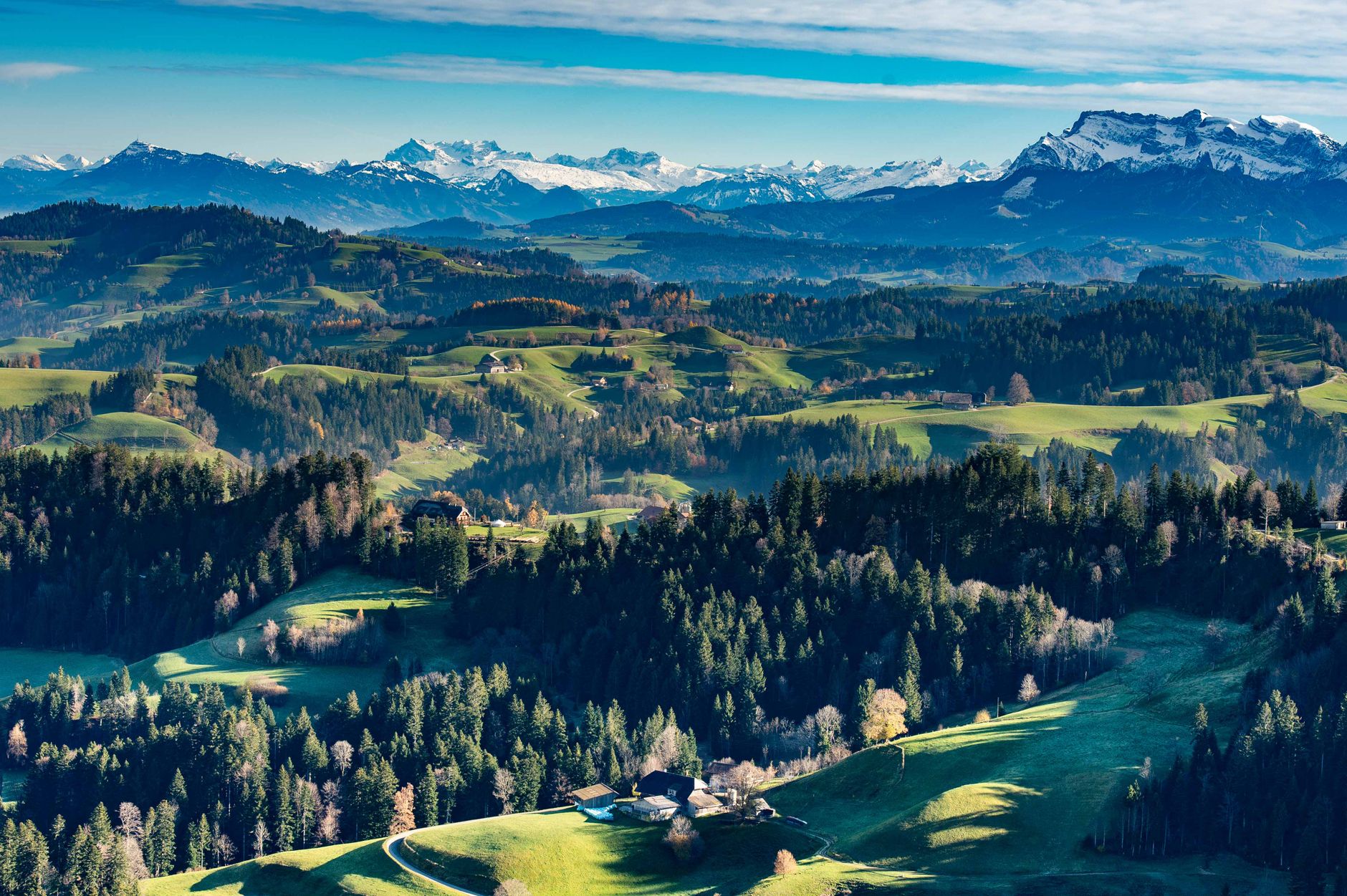
A stunning autumn view of Swiss mountains and colorful forests in Schwyz, Switzerland.
A stunning aerial view of the Swiss Alps featuring a serene blue lake and lush green landscape.
Breathtaking aerial view of Langnau im Emmental with lush hills and distant Swiss Alps under a clear sky.
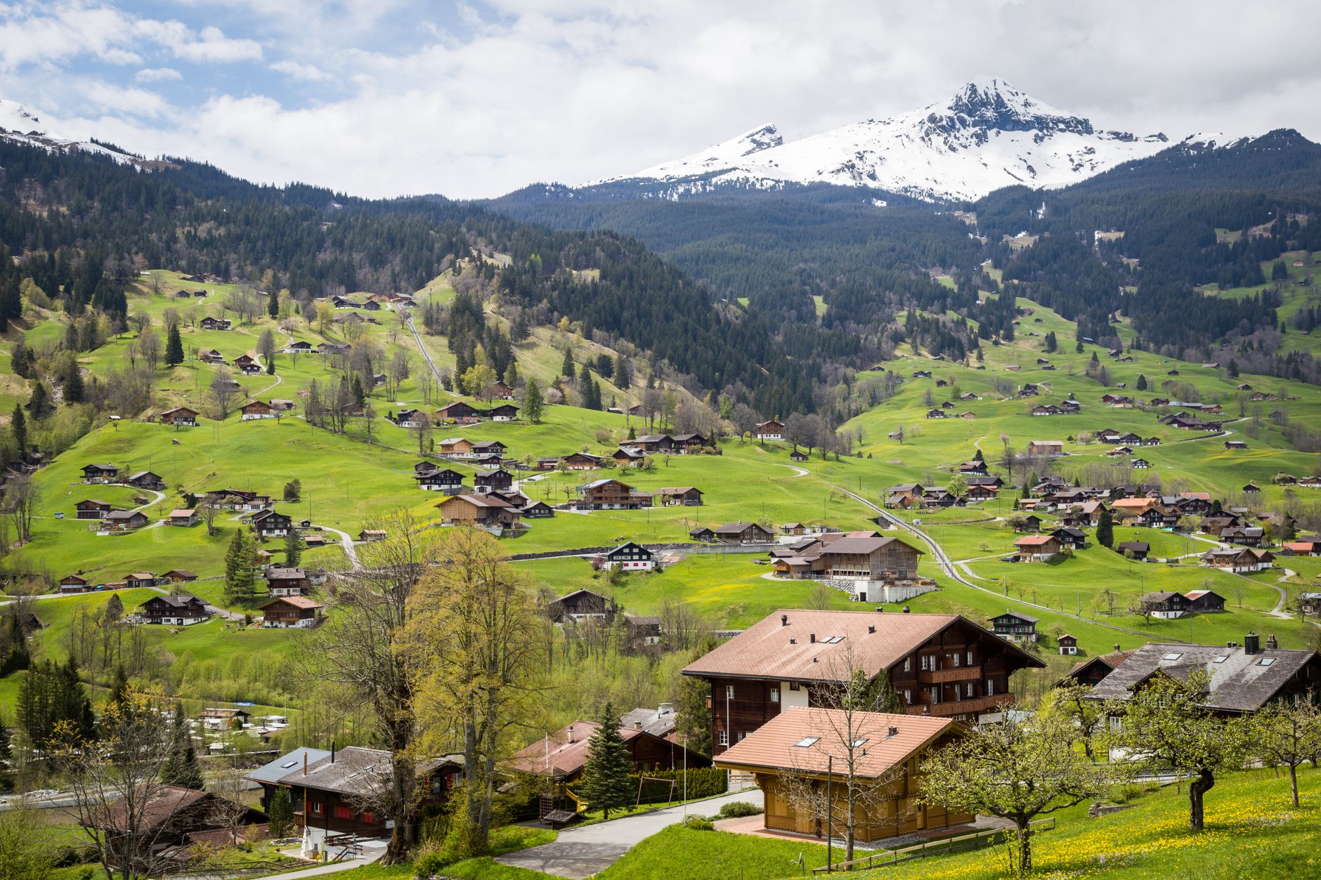
Charming village surrounded by lush green hills and snowy mountains in Interlaken, Switzerland.
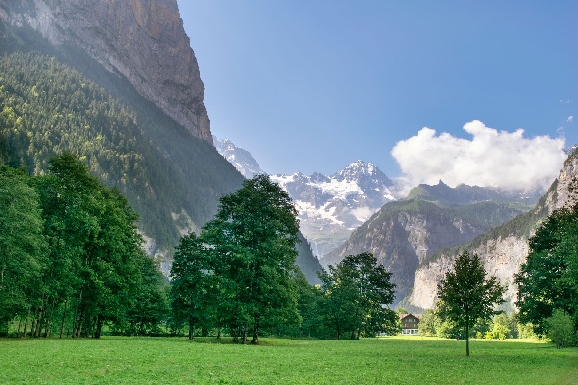
Stunning Alpine scene with lush green valley, towering peaks and blue sky with clouds.

Upcoming departures

DatesPrice / personAvailability
9 Aug – 15 Aug 2026(price may vary)
CAD 2,790Only a few spots
Book my trip
16 Aug – 22 Aug 2026(price may vary)
CAD 2,790Sold out
Book my trip
23 Aug – 29 Aug 2026(price may vary)
CAD 2,790Sold out
Book my trip
30 Aug – 5 Sep 2026(price may vary)
CAD 2,790Sold out
Book my trip
UT
Operated by UTracks

TripFinder compares the available catalog facts and can help with the booking. You travel under the operator's terms; final price and availability are confirmed before purchase.

Book my trip →
Ask Theo about this trip
From
CAD 2,790 CAD / person
Twin share · prices may vary by departure
Next departures
Aug 9, 2026CAD 2,790 · spots left
Sep 6, 2026CAD 2,790 · available
Jul 4, 2027CAD 2,990 · available
See all 16 departures →
Book my trip
No payment now — tell us a few details and an expert confirms everything & finishes your booking.
✓No payment & no obligation to send a request
✓An expert confirms by email or phone — your choice
Prefer to talk first? Send a request and choose phone as your contact preference.
Operated by UTracks · view on operator site ↗

More Europe adventures

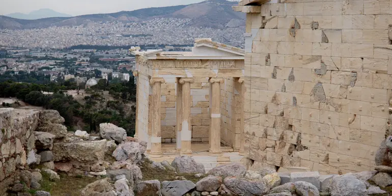
OpeningZagreb to Santorini: 35 Unforgettable Days image
GG Adventures
Save 20%

Zagreb to Santorini: 35 Unforgettable Days

Bosnia and Herzegovina, Albania, Greece, Montenegro, Croatia · 35 days · Easy

fromCAD 8,639
Next: 09 Aug
OpeningUltimate Europe: Berlin, Tuscany & Greek Temples image
GG Adventures
Save 35%

Ultimate Europe: Berlin, Tuscany & Greek Temples

Albania, Austria, Czechia, Greece, Netherlands, Montenegro, Germany, Italy, Croatia · 34 days · Easy

fromCAD 5,960
Next: 09 Aug
OpeningOne Month in Europe: Germany, Italy & Croatia image
GG Adventures
Save 25%

One Month in Europe: Germany, Italy & Croatia

Albania, Austria, Czechia, Greece, Netherlands, Montenegro, Germany, Italy, Croatia · 30 days · Easy

fromCAD 5,310
Next: 09 Aug
From
CAD 2,790/ person
Book my trip